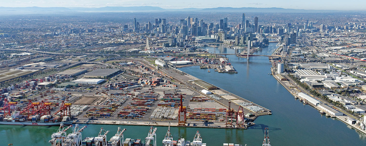
The Port and Inner West precinct, when placed within a strategic land use and spatial planning framework, has the potential to transform Melbourne’s economic and social geography.
The situation
Located between Melbourne’s CBD and Footscray Central Activities Area, the Port and Inner West precinct is of strategic significance to the State; as a gateway to international goods trade for Australia, and as a potential urban activity corridor capable of accommodating the expansion of Melbourne’s knowledge economy.
The precinct is also at the nexus of several multi-billion dollar road, rail, port and urban projects. The objectives of the Conceptual Framework are to:
- Support Australia's trade growth and prosperity by:
- Providing essential land and infrastructure to enable competitive port and freight systems
- Extending the capital city knowledge economy via an urban activity corridor between the Central Business District and Footscray Central Activities District (CAD).
- Facilitate integrated planning and delivery of infrastructure, transport and land use initiatives to maximise the competitiveness, productivity, sustainability and liveability of Melbourne
- Capitalise on opportunities in the precinct to progress key Commonwealth and State planning and infrastructure policy objectives.
- Analysing and documenting land use, functional and physical attributes of the precinct and how it relates to wider metropolitan functions
- Analysing existing and planned operations for the Port of Melbourne and adjacent freight activities
- Developing a comprehensive “map” of strategic decisions and interactions across all major projects within or influencing the precinct
- Articulating the drivers of change that should be addressed when considering infrastructure investment and land use change in the precinct
- Articulating the economic value of the port and freight activities and the economic value of the inner city knowledge and service economy
- Interpreting key State and Commonwealth policy documents to derive a set of core functional elements to be provided within the precinct
- Identifying critical success factors for each of the functional elements to guide the definition of land use structure, labour and operations, and inform triple-bottom-line evaluation
- Undertaking a high-level risk assessment
- Setting initial directions for spatial planning of the functional elements.
Approach
Advisian was engaged by both the Victorian Department of Transport and Department of Planning & Community Development to assist with the design and facilitation of an integrated planning process to assist with major land use change.
The assignment involved establishing an appropriate framework for the initiative and coordinating the production of a strategic guidance document to steer future thinking and decision-making for the precinct, where some stakeholder objectives were not fully compatible.
Our services included:
Advisian continues to advise government on strategic road network considerations for the future development of the precinct, and on transport issues for several of the major urban development initiatives in the inner west.
Results
Advisian provided a clear functional mix for the precinct, which gave better certainty to proponents whose projects occur within the precinct and further enhanced the level of collaboration between government agencies and departments.
The framework provided a way to move forward on the precinct, aligning specific stakeholder objectives that were not always compatible with each other.


